
Share
GeoAxis
Identify any image's location using AI without metadata or GPS. Provides precise global geolocation in seconds.
General Information about GeoAxis
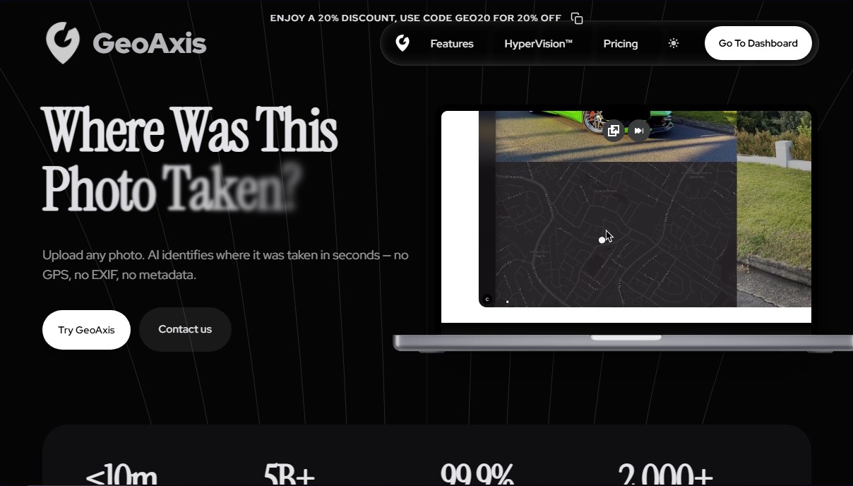
GeoAxis is an AI-powered image geolocation tool designed to pinpoint the exact location of any photograph in seconds. Its primary function is to determine the geographic origin of a capture without relying on GPS, EXIF, or metadata, basing its analysis exclusively on visual content. This solution is particularly useful for Open Source Intelligence (OSINT) researchers, cybersecurity professionals, data analysts, and organizations requiring precise and scalable location intelligence.
The platform's operation is powered by its proprietary HyperVision™ technology, an advanced AI engine that processes an image’s visual elements to compare them against a massive database of over 5 billion indexed images. Through this approach, GeoAxis can recognize landmarks, topography, and urban features in more than 2,000 cities worldwide. In deployed urban environments, the system offers an accuracy of less than 10 meters, ensuring reliable results through state-of-the-art computer vision algorithms.
The tool offers various capabilities and analysis modes tailored to different levels of detail:
- Geo-Estimation: Provides a general estimate of the area or region where the photo was taken.
- Precise Geolocation: Exact location via geographic coordinates based on visual pattern recognition.
- Cross-platform Analysis: The service is optimized for both desktop and mobile devices, facilitating access from anywhere.
- Report Exporting: The ability to generate PDF reports with detection results for professional use.
- API Access: Allows companies to integrate GeoAxis technology directly into their own systems or workflows.
Beyond its processing power, the platform stands out for its robust infrastructure, offering a 99.9% uptime SLA. Regarding security, it implements enterprise-grade data protection measures, ensuring the privacy of all queries remains intact. Its interface is designed so that any user can identify a photo's location in less than a minute by simply uploading the file to the dashboard.
As a geospatial AI tool, GeoAxis positions itself as an advanced alternative for those who need to verify image authenticity or locate scenes quickly and automatically. Soon, the platform will expand its features with indoor geolocation and vehicle identification capabilities, consolidating its applied visual intelligence ecosystem. Its technical and neutral approach makes it a practical resource for decision-making based on precise geographic data.
Features and Use Cases of GeoAxis
How GeoAxis Works
Frequently Asked Questions about GeoAxis
What is GeoAxis and how does the tool work?
GeoAxis is an AI-powered image locator that identifies the exact location of any photo in seconds by analyzing visual content without the need for GPS data.
Do my photos need EXIF metadata for GeoAxis to recognize them?
No, it isn’t necessary. Our advanced AI technology analyzes visual elements within the image to determine the location independently of any hidden file data.
How accurate is HyperVision technology?
In cities where the system is deployed, accuracy is within ten meters, thanks to our database of over five billion indexed images.
Is there a promo code for a subscription discount?
Yes, you can use the code GEO20 to get 20% off when you sign up for any of our paid plans.
What are the advantages of the GeoAxis Business plan compared to the Pro plan?
The Business plan includes all Pro features, plus 50 API calls per month, higher query limits, and priority technical support.
Is it safe to upload my personal images to the platform?
We guarantee maximum privacy and data protection through enterprise-grade security measures applied across every layer of our infrastructure.
When will indoor geolocation features be available?
We are currently working on new capabilities, such as indoor geolocation and vehicle identification, which will be added to our toolset soon.
Can I use GeoAxis for free?
Yes, we offer the chance to test our AI geolocation technology for free before you commit to a subscription plan.
What kind of support do Enterprise plan users receive?
Enterprise users receive priority support, access to new AI models, and custom city deployments tailored to their specific needs.
Is it possible to export location results?
Yes, paid plans allow you to export location data and maps in PDF format to make creating professional reports easier.
GeoAxis Pricing
Free Version: GeoAxis offers a free trial option so users can test the tool and geolocate images using AI at no initial cost.
Pro Plan: $29.99/month (or $23.99/month billed annually).
Unlimited location detections.
HyperVision™ Accuracy (margin of error under 10 meters).
Web and mobile access.
Export results in PDF format.
Business Plan: $79.99/month (or $63.99/month billed annually).
Includes all Pro plan features.
50 API calls per month limit.
Higher query limits.
PDF export.
Priority support.
Enterprise Plan: Custom pricing (Contact Sales).
Custom city deployment.
Unlimited API access.
Access to new AI models.
Use across all platforms and devices.
Advanced PDF exports.
Priority support.
GeoAxis Screenshots