

Share
Geospatial intelligence platform converting satellite data into precise analytics to monitor the environment and facilitate climate decision-making.
What is OlmoEarth by Ai2?
OlmoEarth by Ai2 is a comprehensive planetary intelligence platform designed to transform massive geospatial data into actionable, decision-ready information. This ecosystem of AI foundation models enables organizations, researchers, and communities to analyze complex Earth data without the need for in-house artificial intelligence experts. Its primary function is to facilitate continuous planetary monitoring through the efficient processing of satellite imagery and millions of global observations.
The technology behind OlmoEarth is based on a family of open-source models developed by the Allen Institute for AI. The platform offers an end-to-end solution covering the entire data lifecycle: from raw geospatial data ingestion and basic research to fine-tuning, custom embedding creation, and production deployment. Thanks to its optimized architecture, it can perform satellite data inference at a continental scale, completing processes that previously required months of computation in just a few hours.
Key technical capabilities and operational benefits include:
- State-of-the-Art Performance: Outperforms current benchmarks, achieving up to 97% accuracy in identifying ground-level changes.
- Data Efficiency: Enables the generation of precise maps using only a fraction of the data points required by traditional models.
- Cost Optimization: OlmoEarth v1.1 reduces computing costs by up to three times, making constant monitoring feasible within realistic budgets.
- Open Architecture: The models, source code, and training data are openly available to foster transparency and scientific innovation.
This tool is particularly valuable for sectors dedicated to environmental conservation, natural resource management, and climate security. Users can leverage OlmoEarth by Ai2 for critical applications such as developing next-generation fire risk models, global mangrove mapping, or protecting marine ecosystems by detecting offshore activities in near real-time.
The ecosystem is complemented by OlmoEarth Studio, a tool for exporting custom data representations for derivative analysis, and an OlmoEarth API that facilitates the integration of these capabilities into existing technological infrastructures. Thus, the platform combines the power of deep learning applied to remote sensing with accessibility designed to create a real and rapid impact on environmental management.
OlmoEarth by Ai2 features and use cases
How to use OlmoEarth by Ai2
OlmoEarth by Ai2 FAQ
What is OlmoEarth by Ai2 and what is its primary function?
OlmoEarth is a planetary intelligence platform that transforms geospatial data and global observations into actionable insights for decision-making, without requiring users to be AI experts.
Is advanced AI knowledge necessary to use OlmoEarth?
No, the platform is designed for accessibility and streamlines the entire process—from raw data acquisition to results analysis—allowing organizations without advanced technical expertise to see immediate benefits.
How much time is saved in data processing with OlmoEarth by Ai2?
Thanks to its efficiency, tasks that previously took months of processing can now be completed in just a few hours, significantly reducing the time needed to obtain up-to-date planetary analysis.
Can I customize or fine-tune models on the platform?
Yes, OlmoEarth offers a comprehensive solution that includes tools for fine-tuning, creating embeddings, and deploying custom models tailored to the specific needs of each project.
Where can I find OlmoEarth’s open-source models?
The foundational models and the tool's source code are openly available to researchers and developers through platforms such as Hugging Face and GitHub.
How can I request access to start working with OlmoEarth by Ai2?
To get an account and start using the platform, you should contact the team through the account request section available on the official website.
Does OlmoEarth offer technical documentation for using its API?
Yes, the platform has a dedicated technical documentation section providing the necessary instructions to access and use the OlmoEarth API effectively.
What level of accuracy do OlmoEarth by Ai2 models offer?
Tests indicate an accuracy rate of up to 97% in data processing, ensuring reliable results for critical applications such as wildfire monitoring and ocean conservation.
OlmoEarth by Ai2 pricing and plans
Open Models and Research Resources (Free)
Download fully open geospatial AI foundation models via Hugging Face.
Free access to model source code on GitHub.
Availability of datasets used for pre-training.
Comprehensive technical documentation for implementation in research projects.
OlmoEarth Platform
Pricing: Visit the official website (account request and team contact required for access).
End-to-end solution for scalable planetary intelligence.
Tools for model fine-tuning and custom embedding exports.
Access to the OlmoEarth API for production integration and deployment.
Continental-scale satellite inference capabilities in just hours.
Continuous monitoring with high compute cost efficiency.
Interface designed to deliver decision-ready insights without requiring AI expertise.
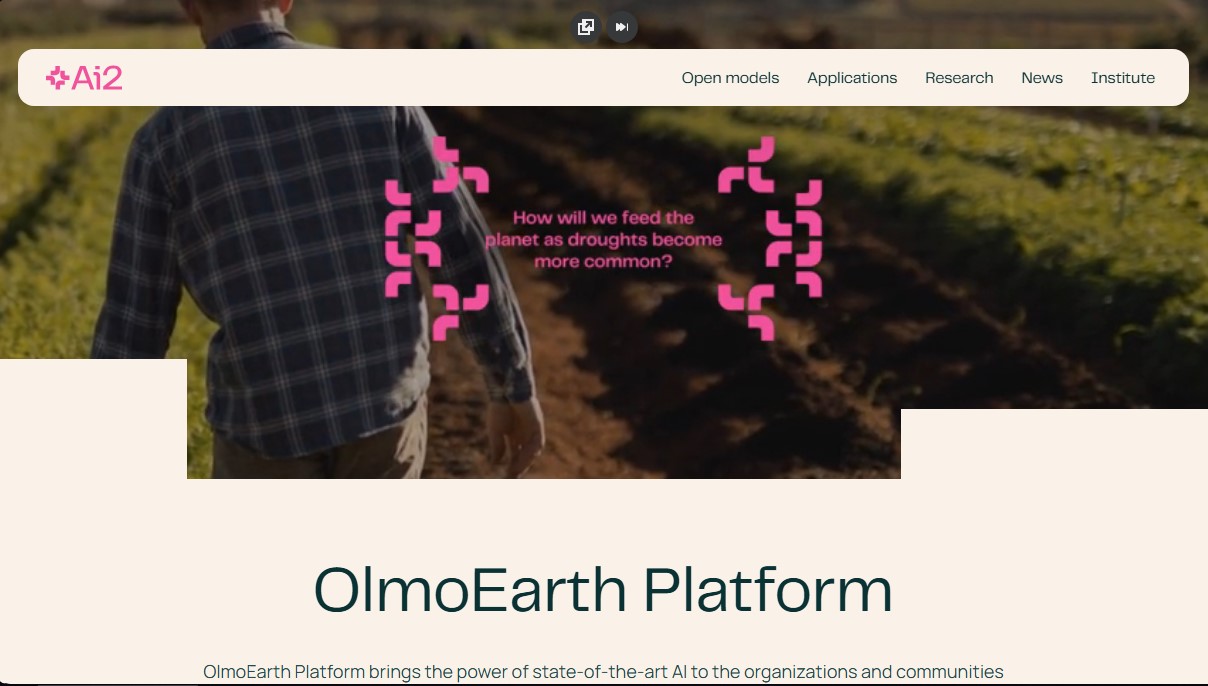
OlmoEarth by Ai2 Screenshots
OlmoEarth by Ai2 alternatives
Rock Identify
Identify rocks, crystals, and minerals using photos. Analyze features like texture and grain to suggest types, explain properties, and answer geological questions.

ImageToSTL.org
Convert JPG and PNG images into STL files for 3D printing using AI. Generate detailed 3D models ready for instant download.



image2slides
Convert screenshots and photos into editable PowerPoint slides. Extract text and graphics to modify and export them in PPTX format.

The Face Analysis
Analyze facial symmetry, proportions, and features with AI. Works privately in-browser with no uploads or registration to identify eye and nose shapes.